South Peak

5 10 2018
A picnic table greets hikers at the top of South Peak.

The Basics

Hike Highlights

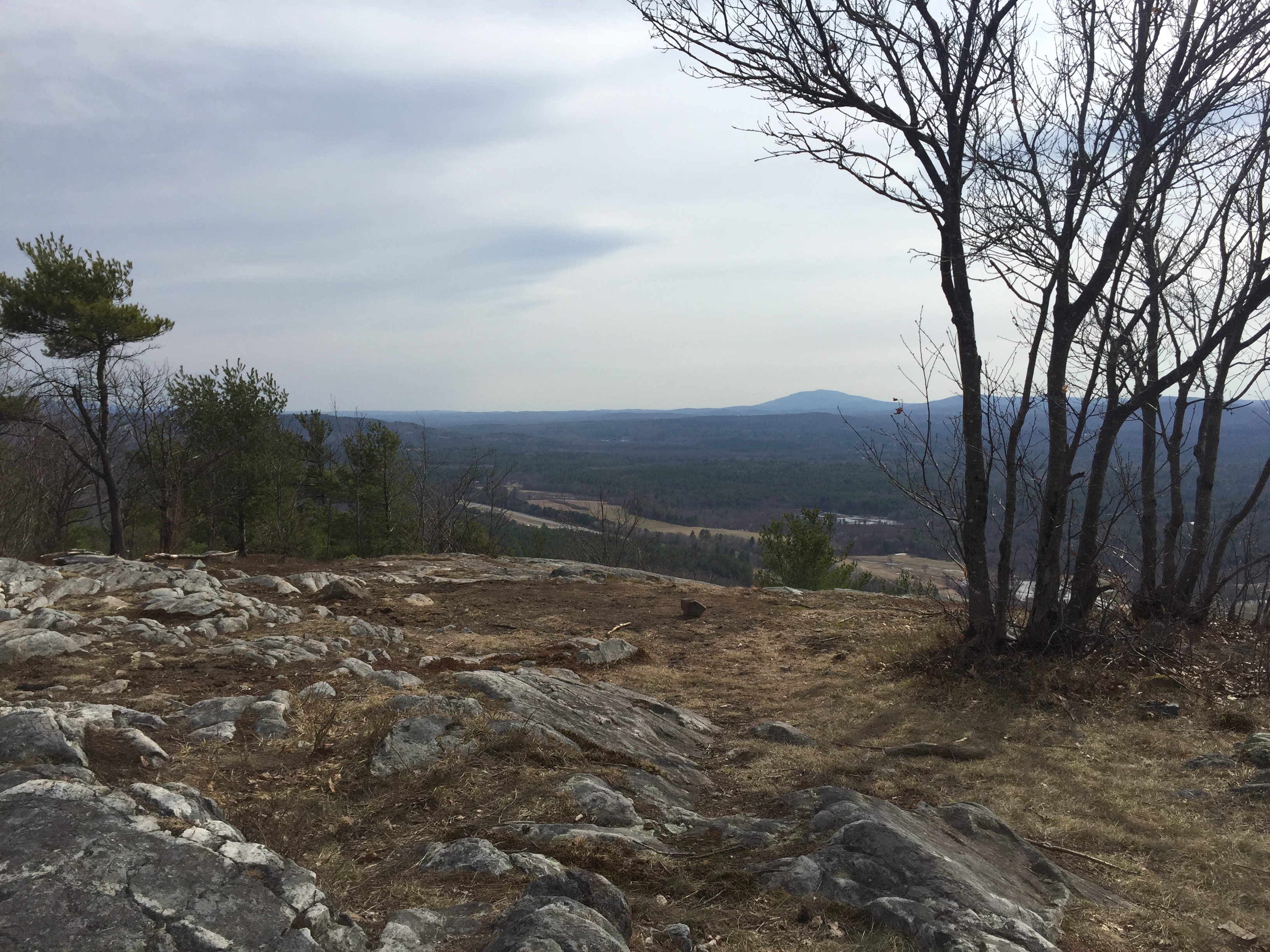
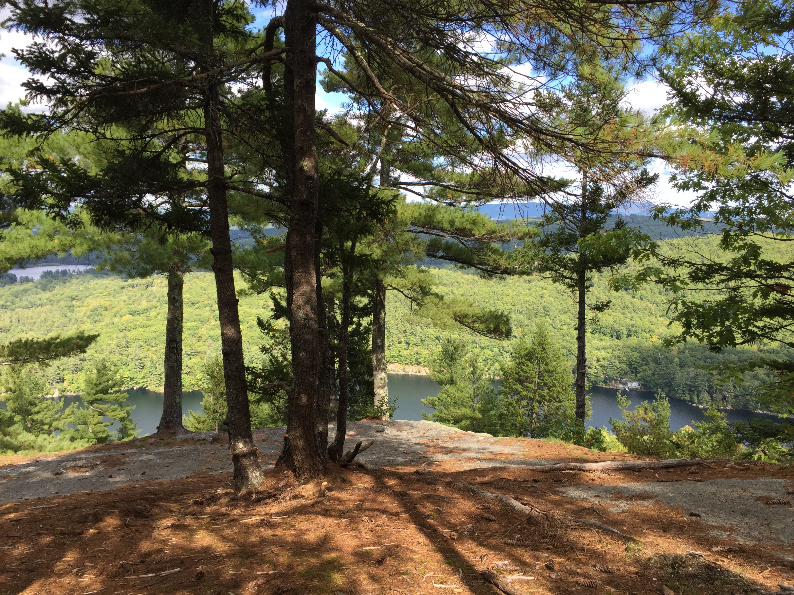
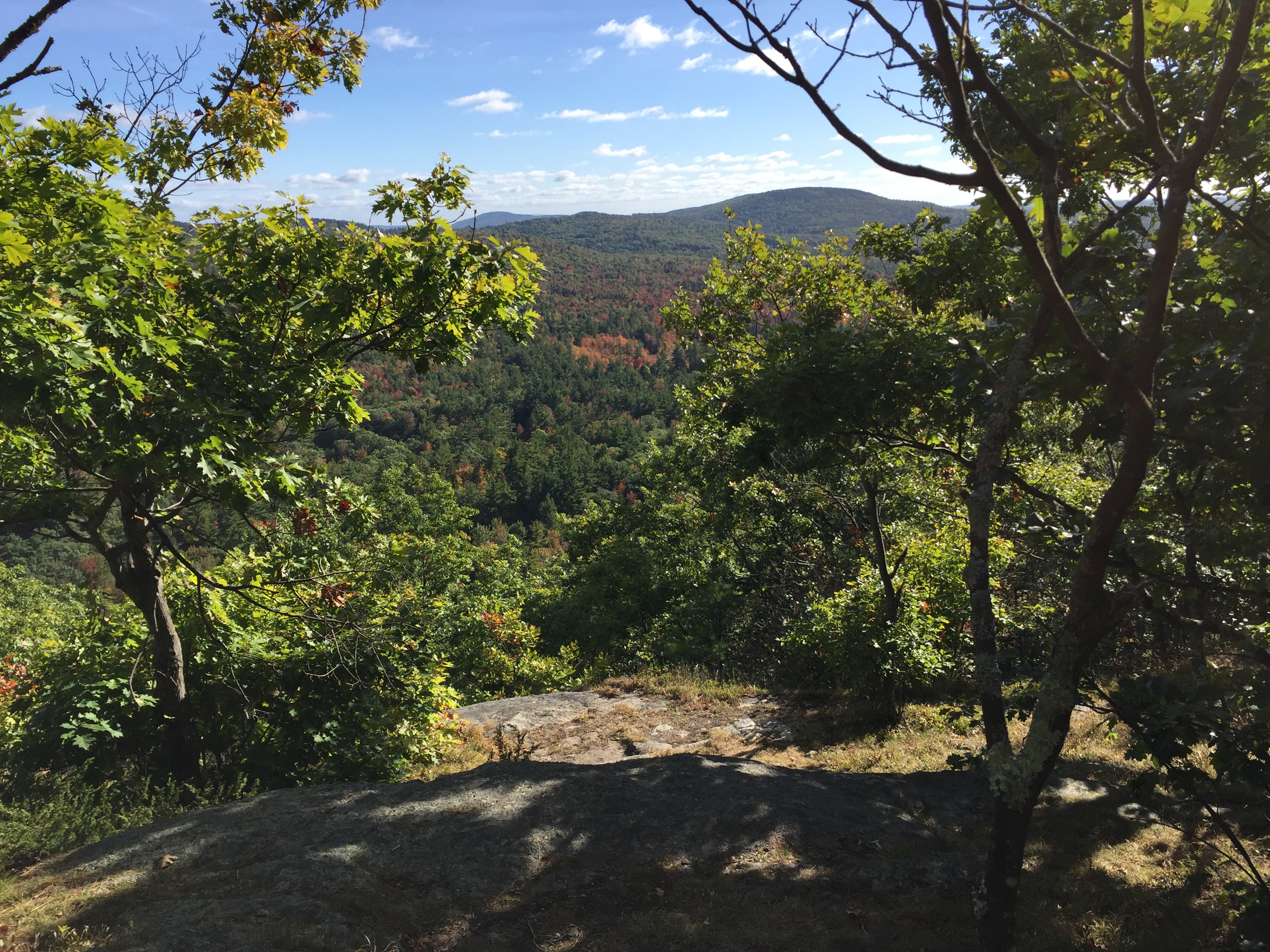
This hike in the 453-acre Whitten Woods leads to a summit with excellent views of surrounding lakes and mountains. Squam Lake, Mount Whiteface and Mount Chocorua are all visible. North Peak also features views, although that summit is not covered. A trail map (PDF) is available.

Directions

The Trail

  1. From the parking lot off Highland Street, enter the woods by the gate.
  2. After about 0.5 miles, turn left onto South Peak Trail and follow it to the summit.
  3. Return along the same trail back to the parking area.


Blood Hill

7 07 2018
The summit of Blood Hill.

The Basics

Hike Highlights

This hike in the 169-acre Wiita Conservation Area leads to the highest point in Middlesex County. Blood Hill affords nice directional views of the nearby landscape and Southern New Hampshire hills.

Directions

The Trail

  1. From the parking lot at the end of Luke Road, enter the woods at the gap in the fence.
  2. Follow the path to the summit. The steepest section comes around 1,400 feet in elevation.
  3. Return along the same trail back to the parking area.


Hedgehog Mountain

15 04 2017

NH - Deering - Hedgehog Mountain

  • Location: Hedgehog Mountain Forest, Deering, New Hampshire
  • Owner: Society for the Protection of New Hampshire Forests
  • Highlights: Nice view to the west
  • Description: This hike brings people to an overlook on Hedgehog Mountain that features expansive views to the west. Hikers can see Croteched Mountain, Hawthorne Feather Airpark and other sights.
  • Directions (from Boston): 89.8 miles, 1 hour 33 minutes

  • The Trail: 1.5 miles, round trip
    1. From the parking lot, continue on Hedgehog Mountain Road.
    2. Turn off the wide dirt road at a blue sign directing hikers to the left.
    3. Follow this trail and turn right shortly before the overlook.
    4. Return to the parking lot following the same trail.
  • A trail map is available here (PDF).


Bald Ledge

24 09 2016

NH - New Hampton - Bald Ledge

    • Location: New Hampton, New Hampshire
    • Highlights: A directional view of lakes, hills and mountains.
    • Description: This hike in New Hampshire’s Lakes Region leads from Sky Pond Road to Bald Ledge, a cliff above Winona Lake. From the cliff, Winona Lake, Lake Waukewan and Hawkins Pond are visible along with many nearby and further away hills/mountains
    • Directions (from Boston): 105 miles, 1 hour 51 minutes

    • The Trail: 1.6 miles, round trip
      1. The trail begins at the end of Sky Pond Road. Parking is available in the nearby lot by Sky Pond.
      2. The trail turns left by a gate and travels beyond the gate.
      3. Turn right at a sign for Bald Ledge and follow the path to the cliff.
      4. Return via the same route.


Roger Myrick Outlook

4 10 2015

nh-sharon-roger-myrick-outlook

    • Location: Sharon, New Hampshire
    • Highlights: A directional view of the nearby countryside.
    • Description: Roger Myrick Outlook is a nice outlook just off the Wapack Trail. There are more views if one continues further along the Wapack Trail.
    • Directions (from Boston): 65.9 miles, 1 hour 38 minutes

    • The Trail: 0.68 miles, round trip
      1. From the parking area on Temple Road, cross the street.
      2. Follow the Wapack Trail uphill.
      3. At the sign for the outlook, look for the nearby ledge overlook.
      4. Return along the same route.