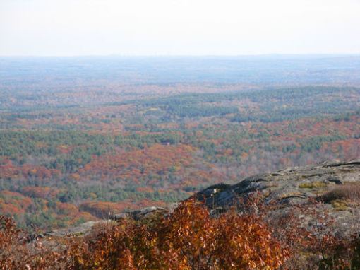
Mount Watatic

26 10 2008

MA - Ashburnham - Mount Watatic

  • Location: Ashburnham, MA
  • Owner: State and local ownership
  • Highlights: A rather strenuous hike to a stunning 180 degree panorama of central and eastern Massachusetts including the Boston skyline; well worth the effort; located at the end of the Midstate Trail and beginning of the Wapack Trail
  • Directions (from Boston): 72.5 miles, 1 hour 28 minutes
  • The Trail:  
    1. The trail first follows Nutting Hill Road, an old gated country road, passing a marshy pond.
    2. Soon after the pond, turn right onto a yellow-blazed path.
    3. The path passes between two large boulders before beginning the major ascent.
    4. Some sections are steep.
    5. Pass two directional viewpoints before reaching the summit.  
    6. From the summit one can continue a little further to a second summit although I did not try that.  The trail to it appeared obvious though.
    7. Return on the same trail or a longer loop hike to the New Hampshire boarder is available.  
  • The best trail map online that I have found is from the Massachusetts DCR resource management plan for Mount Watatic Reservation here (PDF file).