
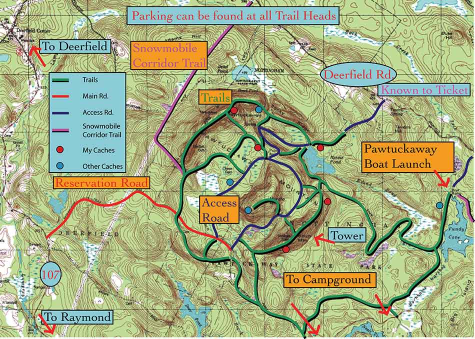
- From the parking area head past a gate (which may be closed or open) following the dirt road.
- After a very short distance, turn right onto the trail.
- After following the trail for a little bit, you will encounter a split. Although the trail leading left is marked with a sign for the fire tower, the righthand trail will also work (it’s a little steeper and has more rock to navigate around.)
- I stayed on the left trail following it by a marsh, keeping the mountain ridge to the right.
- After climbing uphill a bit, the trail enters out into a parking area (this is accessable from the loop roads mentioned in the directions section). From the parking area, follow a trail to the right.
- This trail climbs somewhat steeply until it emerges at a clearing containing the fire tower. Off to the right is a ledge with an open view although from the fire tower base, the view is slightly masked by trees. Hikers can climb the fire tower for a 360 degree view, although there are also excellent vistas from ledge surrounding the summit for the faint of heart.
- Comming down Pawtuckaway South, I decided to follow the ridge trail which exits from the opposite side of the fire tower from which you arrived.
- This trail gradually winds its way through rocky sections, progessivly droping back down the mountain.
- After descending, it meets up with another trail (by a marker 5). Do not turn on this trail.
- A short while later, it joins the initial trail at the split described in step 2.
- From here it is a short walk back to the dirt road which leads to the parking area.
